Race Information
NOTE: Registration closes September 27, 2025
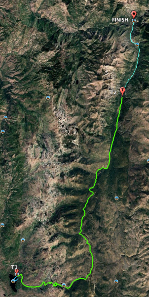
This triathlon and relay takes advantage of the unique topography of the area from Warm Lake to Yellow Pine. This point-to-point race consists of a 1 mile, open water swim, a 27 mile bike ride, and a 7 mile run. It covering an elevation change from 5300' up to 7300' and back down to ~4900'. The road from Warm Lake to Landmark is paved. From Landmark to Yellow Pine the road is dirt. Traffic control will be in place.
Able-Bodied and Adaptive Athletes will be able to participate individually in the full triathlon or as a relay triathlon in teams of three (3) participants. Sign-in is Friday, October 2, 2026 from 4:00 pm to 7:00 pm in the courtyard at Warm Lake Lodge.
The race starts on Saturday, October 3, 2026, at 10:00 AM Use the link above to view the course route in Google Earth.